
Earth is filled with places that seem almost impossible to describe with ordinary words. Some landscapes are shaped by enormous geological forces, while others have been transformed over generations by people who learned to live alongside mountains, deserts, forests, and oceans. Beyond the destinations that dominate travel advertisements are countless locations where unusual scenery, distinctive cultures, and remarkable natural environments create experiences that feel completely different from everyday life.
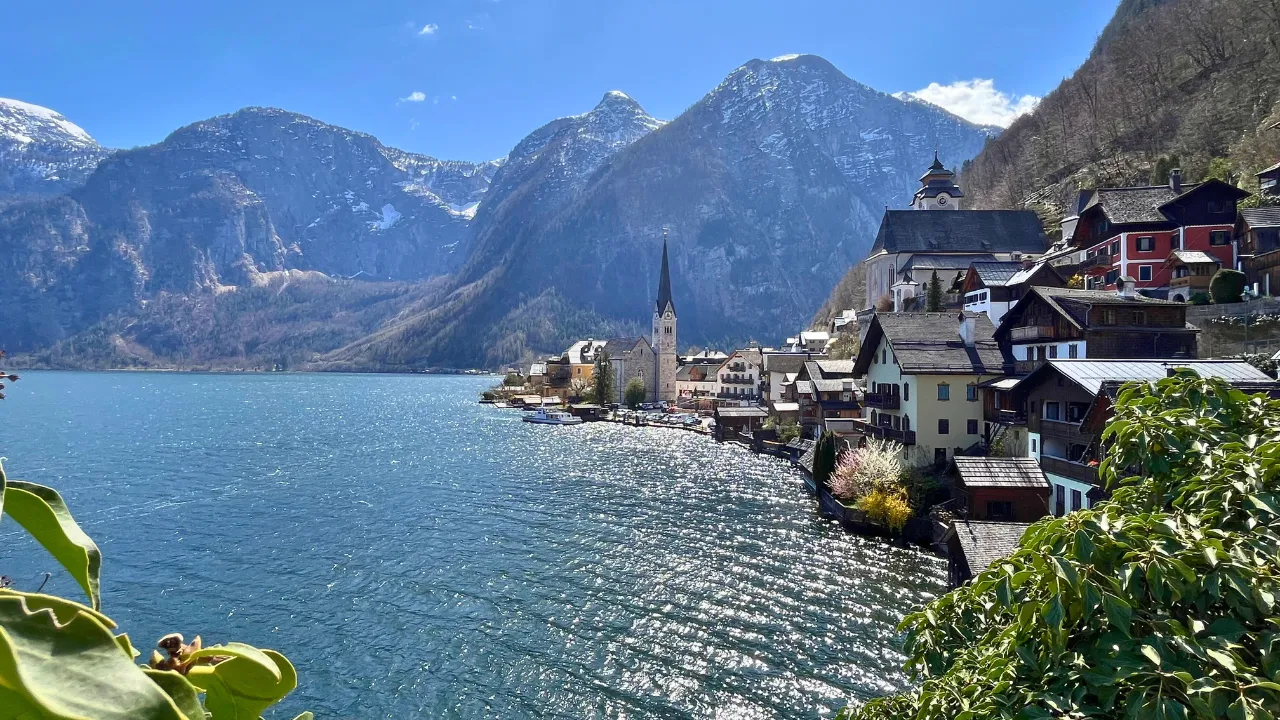
Exploring these places is not always about finding the most famous landmark. Sometimes the most memorable discoveries come from quiet valleys, isolated coastlines, unusual rock formations, ancient settlements, or remote communities. Each location carries its own story, shaped by geography, climate, history, and human adaptation.
The following destinations represent different examples of the extraordinary variety found across our planet. Together, they demonstrate how much diversity can exist within a single world.
The Turquoise Lakes of Jiuzhaigou
In the mountains of southwestern China, Jiuzhaigou is known for clear lakes, forested valleys, waterfalls, and colorful landscapes. The region’s name is associated with nine Tibetan villages, reflecting the cultural history of the area.
Its lakes are especially striking because mineral deposits and underwater formations can create vivid shades of blue and green. Surrounded by mountains and forests, the water can appear remarkably clear under suitable conditions.
The landscape also changes with the seasons. Autumn brings different colors to the surrounding forests, while winter can transform waterfalls and lakesides with snow and ice.
Beyond its visual beauty, Jiuzhaigou demonstrates the importance of protecting sensitive mountain ecosystems. Its forests, waterways, and wildlife form a connected natural environment that depends on careful conservation.
The Marble Caves of Patagonia
On the Chilean side of Patagonia, the shores of General Carrera Lake contain unusual formations known as the Marble Caves. Over long periods, waves have shaped the carbonate rock along the lake’s edge, creating smooth walls, tunnels, and curved surfaces.
The colors and patterns of the rock can change depending on the water level, weather, and sunlight. When the lake is calm, reflections can make the caves appear even more dramatic.
The formations are best understood as products of natural processes rather than structures created by humans. Wind, water, rock composition, and time have worked together to produce their unusual shapes.
Reaching the caves can require travel through remote parts of Patagonia, adding another dimension to the experience. The journey through the surrounding landscape provides an opportunity to appreciate the scale and isolation of southern South America.
The Painted Hills of Oregon
The Painted Hills in the United States contain layers of sediment that display shades ranging from yellow and gold to red and dark brown. These colors were produced by ancient geological processes involving volcanic ash, climate changes, and mineral deposits.
The hills are part of a larger protected landscape in Oregon and provide a visible record of environmental changes that occurred over millions of years.
Their appearance changes throughout the day as sunlight moves across the slopes. Rain can also temporarily deepen the colors, making the landscape look different from one visit to another.
Unlike landscapes dominated by vegetation, the Painted Hills expose geological history directly on the surface. Their layers allow visitors to see evidence of a distant environment that existed long before modern humans appeared.
The Green Mountains of Madeira
Madeira, an Atlantic island belonging to Portugal, combines steep mountains, volcanic landscapes, forests, and dramatic coastlines. The island’s terrain creates a wide range of environments within a relatively small area.
One of Madeira’s distinctive features is its network of irrigation channels known as levadas. These channels were developed to transport water across difficult terrain and remain closely connected with many walking routes.
The mountains can become covered in mist, creating a completely different atmosphere from the sunny coastal areas. Deep valleys and dense vegetation contribute to the island’s distinctive character.
Madeira demonstrates how natural landscapes can influence human engineering. The levadas show how residents adapted water management to steep volcanic terrain while creating routes through areas that would otherwise be difficult to cross.
The Salt Flats of Bolivia
Salar de Uyuni in Bolivia is the world’s largest salt flat and covers an enormous area of the Altiplano. During the dry season, the surface can appear almost completely white, creating an immense landscape with very few visible features.
During periods of shallow flooding, a thin layer of water can cover parts of the salt flat. Under calm conditions, the surface reflects the sky and creates an unusual visual effect.
The salt flat was formed through geological processes involving ancient lakes that eventually disappeared, leaving behind mineral-rich deposits.
The region is also important for local communities and natural resources. Its landscape demonstrates how geological history can create environments that are both visually remarkable and economically significant.
The Fiery Landscapes of Iceland
Iceland sits on a geologically active part of the planet where volcanic and tectonic processes continue to shape the land. This creates a remarkable combination of lava fields, glaciers, waterfalls, geothermal areas, black sand beaches, and mountains.
In some areas, steam rises from the ground as geothermal heat reaches the surface. Elsewhere, ancient lava flows have been gradually covered by vegetation.
The contrast between ice and volcanic terrain makes Iceland particularly distinctive. Glaciers can exist relatively close to areas shaped by volcanic activity, demonstrating the interaction between different natural forces.
The island also offers a clear reminder that landscapes are not permanent. Geological processes continue to reshape the environment, sometimes gradually and sometimes through dramatic events.
The Red Cliffs of Wadi Rum
Wadi Rum in southern Jordan contains vast desert landscapes dominated by sandstone mountains, cliffs, valleys, and open plains. The area has been shaped by wind, erosion, and geological processes over enormous periods.
The desert is also closely associated with Bedouin culture and has a long history of human movement through the region.
Large rock formations rise dramatically from the desert floor, creating shadows and changing colors as the position of the sun shifts. At sunrise and sunset, the sandstone can appear in different shades of red, orange, and brown.
The landscape shows how deserts are far more diverse than simple fields of sand. Rock formations, narrow valleys, natural arches, and ancient inscriptions provide evidence of both geological and human history.
The Ancient Terraces of Banaue
In the mountainous Philippines, the Banaue Rice Terraces demonstrate how people can reshape steep landscapes for agriculture. Terraces were constructed along mountain slopes, creating levels where rice could be cultivated.
The system depends on careful water management and the relationship between different sections of the landscape. Rather than treating the mountains as an obstacle, generations of farmers developed methods for adapting agriculture to the terrain.
The terraces are important not only for their appearance but also for the knowledge and labor represented by their construction and maintenance.
Their continued survival depends on both environmental conditions and community practices. This makes them an example of a cultural landscape in which nature and human activity are closely connected.
The Otherworldly Landscapes of Cappadocia
Cappadocia in central Turkey is famous for its unusual rock formations, underground spaces, valleys, and cave architecture. Volcanic materials were deposited across the region and later shaped by erosion.
The softer rock could be carved relatively easily, allowing communities to create rooms, churches, storage areas, and other spaces inside cliffs and rock formations.
Some valleys contain towering formations commonly known as fairy chimneys. Their shapes are the result of differences in the hardness of the geological layers and long-term erosion.
Cappadocia is especially interesting because its natural and cultural histories are impossible to separate. The landscape influenced how people built homes and religious spaces, while human activity added another layer to the appearance of the region.
The Wild Coast of Tasmania
Tasmania contains extensive wilderness areas where forests, mountains, rivers, beaches, and rugged coastlines remain relatively undeveloped. The island’s geographic separation has contributed to the preservation of distinctive ecosystems.
Several plant and animal species found there are adapted to the island’s particular environment. Ancient forests can contain trees that have survived for extremely long periods, while remote coastlines provide habitats for marine and bird species.
The landscape can change rapidly from dense forest to exposed mountains and coastal cliffs. This variety makes Tasmania especially valuable for people interested in wilderness and ecological diversity.
Protected areas play an important role in maintaining these environments. Responsible tourism helps visitors experience the landscape while reducing pressure on fragile ecosystems.
The Limestone Towers of Guilin
The region around Guilin in southern China is known for dramatic limestone peaks rising from river valleys. These formations developed through long geological processes involving soluble rock and water erosion.
The Li River passes through many of these landscapes, creating a combination of water, mountains, villages, and vegetation.
The formations are an excellent example of how erosion can gradually transform a broad geological landscape into distinctive isolated peaks.
Human communities have adapted to the environment for generations. Agriculture, transportation, and settlement patterns developed around the rivers and valleys between the limestone formations.
The result is a landscape where geological history and human activity exist side by side.
The Frozen Beauty of Greenland
Greenland contains one of the world’s largest ice sheets and vast areas of remote Arctic landscape. Massive glaciers, rocky coastlines, icebergs, and small settlements define many parts of the island.
In coastal areas, large pieces of glacial ice can break away and enter the ocean. These icebergs may travel through surrounding waters while gradually changing shape as they melt.
Greenland’s communities are strongly connected to the Arctic environment. Weather, sea conditions, and seasonal changes influence transportation and daily activities.
The island also provides researchers with important information about Earth’s climate history. Ice cores contain layers that preserve evidence from the atmosphere over long periods, allowing scientists to study changes in environmental conditions.
The Hidden Variety of Earth’s Landscapes
One of the most fascinating aspects of exploring the planet is realizing that extraordinary environments do not follow a single pattern. A remarkable destination may be covered in ice, surrounded by desert, hidden inside a forest, shaped by volcanoes, or built into a mountain.
Some places are famous because of their enormous scale, while others attract attention because of unusual geological details or cultural traditions.
What connects them is the relationship between location and time. Mountains rise and erode, rivers change their courses, glaciers advance and retreat, and communities adapt to whatever environments surround them.
This constant change means that Earth’s landscapes are not static displays. They are parts of ongoing natural and human processes.
Discovering Places Beyond the Familiar
Travel often begins with famous destinations, but the world becomes much more interesting when attention moves beyond the locations that appear repeatedly in photographs and advertisements. Less familiar regions can reveal geological formations, traditional architecture, ecosystems, and cultural landscapes that are just as meaningful.
Exploring unusual destinations also encourages greater awareness of conservation. Many remarkable environments are fragile, and increased tourism can affect them through waste, construction, water consumption, and disturbance of wildlife.
Responsible exploration therefore matters as much as the destination itself. Respecting local communities, following environmental guidelines, and avoiding unnecessary damage helps preserve these places for future visitors.
A Planet Filled With Unexpected Stories
The most remarkable corners of Earth are not simply beautiful locations on a map. They are records of geological forces, climate changes, biological adaptation, human creativity, and generations of cultural experience.
A salt flat can preserve evidence of ancient lakes. A mountain terrace can reveal generations of agricultural knowledge. A volcanic island can show how geological forces continue to shape the surface of the planet. A remote forest can preserve species and ecosystems found nowhere else.
Every landscape has something that cannot be fully understood from a photograph alone. Its real character comes from the forces that created it and the people and wildlife that adapted to it.
For travelers and curious explorers, that is perhaps the greatest reason to keep looking beyond familiar routes. The Earth still contains countless places capable of changing the way we understand nature, history, and the extraordinary variety of life across our planet.