
Far from crowded capitals, busy highways, and heavily photographed landmarks, there are landscapes that remain surprisingly unfamiliar to much of the world. Some stretch across enormous deserts, while others are hidden between mountains, surrounded by forests, or scattered along distant coastlines. Their appearance may seem untouched at first glance, but many of these places contain evidence of ancient communities, unusual geological events, forgotten trade routes, and natural changes that occurred long before modern maps existed.
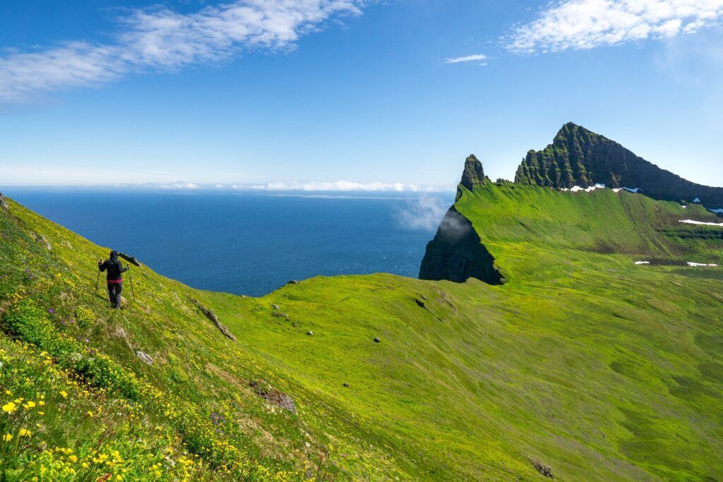
Remote landscapes often preserve stories because fewer people have disturbed them. Old paths can remain visible across valleys, abandoned settlements can survive beneath vegetation, and unusual rock formations can provide clues about geological forces that shaped entire regions. In other places, local communities have carried traditions through generations, keeping knowledge alive even when the outside world knows little about it.
Exploring these landscapes reveals that remoteness does not mean emptiness. Many isolated environments contain layers of history that are still being studied and understood.
The Ancient Landscape of the Taklamakan
The Taklamakan Desert in western China is one of the largest sandy deserts on Earth. Its enormous dunes and harsh climate have made travel across the region difficult for centuries.
Yet the desert was never completely disconnected from human activity. Ancient routes once crossed its edges and connected communities involved in long-distance trade. Archaeological discoveries have revealed settlements, burial sites, textiles, wooden objects, and other remains preserved by the extremely dry environment.
Some ancient organic materials survived because moisture is limited. This has allowed researchers to study objects that would normally decay in wetter environments.
The desert therefore contains an unusual combination of natural isolation and historical evidence. What appears to be an empty sea of sand can contain traces of people who traveled, traded, lived, and eventually disappeared from the landscape.
The Valleys of the Pamir Mountains
The Pamir Mountains extend across several countries in Central Asia and contain some of the world’s most dramatic high-altitude landscapes. Deep valleys, enormous peaks, glaciers, and isolated settlements characterize many parts of the region.
For centuries, these mountains formed part of important movement routes between Central and South Asia. Traders, travelers, armies, and local communities crossed difficult mountain passes connecting distant regions.
Today, some valleys remain sparsely populated and difficult to reach. Traditional settlements can be found beside rivers and agricultural terraces, demonstrating how communities adapted to high-altitude conditions.
The landscape also preserves evidence of changing environments. Glaciers and snowfields influence water availability, while mountain erosion continues to reshape valleys.
The Hidden Canyons of Oman
Oman contains dramatic desert and mountain landscapes that receive less international attention than many famous destinations in the region. The country’s interior includes deep valleys, rocky plateaus, limestone formations, and isolated settlements.
Some mountain valleys contain ancient pathways and agricultural terraces developed to make use of limited water. Traditional irrigation systems helped communities cultivate crops despite an arid climate.
The landscape reveals how human settlement depended on understanding water. Villages often developed near springs, seasonal streams, or carefully managed irrigation channels.
Ancient rock inscriptions and archaeological remains also provide evidence of long-term human presence. These discoveries show that the region’s deserts and mountains were part of complex cultural landscapes rather than empty wilderness.
The Remote Coast of Namibia
Namibia’s Atlantic coastline contains one of the most unusual desert environments on Earth. The Namib Desert reaches the ocean, creating a dramatic meeting point between sand and cold Atlantic waters.
Some areas are extremely dry, yet specialized plants and animals survive by adapting to limited moisture. Coastal fog can provide an important source of water for certain organisms.
The region is also associated with shipwrecks from vessels that were caught along the dangerous coastline. Some sections became known for their harsh conditions, strong surf, and limited access to freshwater.
The landscape therefore contains both ecological and maritime stories. Ancient geological processes shaped the desert, while the ocean created challenges for human navigation.
The Mountain Villages of the Caucasus
Across the Caucasus, remote mountain communities have developed distinctive architectural traditions and ways of life. High valleys can contain stone houses, towers, old paths, and agricultural terraces surrounded by steep peaks.
Some settlements were historically difficult to reach, helping preserve architectural features that might have disappeared more quickly in heavily connected regions.
Stone towers found in parts of the Caucasus served different purposes depending on the community and period. Some were connected with defense, while others were associated with family compounds.
The surrounding landscape also influenced daily life. Harsh winters, steep terrain, and limited farmland required communities to develop careful approaches to food production and storage.
These villages provide an example of how architecture can preserve the memory of environmental challenges faced by earlier generations.
The Great Rift Valley’s Hidden Landscapes
The Great Rift Valley stretches through eastern Africa and contains mountains, lakes, grasslands, deserts, and volcanic landscapes. It is one of the world’s most important geological regions and has also played a major role in human evolutionary history.
Some areas contain fossil evidence that helps scientists study ancient environments and early human relatives. Layers of sediment can preserve bones, tools, pollen, and other clues about conditions that existed thousands or millions of years ago.
The landscapes themselves have changed repeatedly. Lakes have expanded and contracted, volcanoes have erupted, and climates have shifted.
Because of this long history, the Rift Valley is more than a scenic region. It is a natural archive containing evidence about Earth’s geological development and the history of life.
The Forgotten Ruins of the American Southwest
Parts of the American Southwest contain ancient settlements built by Indigenous peoples, including communities associated with the ancestral Puebloan tradition.
Some settlements were constructed in cliffs, while others consisted of large multi-room structures and carefully planned communities. Their locations often reflected access to water, farmland, defensive advantages, and natural resources.
Archaeological research has revealed evidence of agriculture, trade, architecture, and changing settlement patterns. Drought and environmental pressures also appear to have influenced where communities lived and how they organized their settlements.
Many sites remain culturally important to Indigenous communities today. Understanding their history requires respect for both archaeological evidence and the living cultural connections that continue into the present.
The Volcanic Islands of the South Atlantic
Several remote islands in the South Atlantic were shaped by volcanic activity and remain far from major population centers. Their landscapes can include steep cliffs, volcanic peaks, grasslands, and rugged coastlines.
Their isolation has allowed distinctive plant and animal communities to develop. Seabirds and marine species can form enormous colonies where suitable habitats remain protected.
Human history is also present. Some islands became important for navigation, scientific research, fishing, or maritime activity, while others supported small permanent communities.
Because these islands are geographically isolated, changes to their ecosystems can be especially significant. Introduced species and human development can affect native wildlife that evolved without many outside pressures.
The Dry Valleys of Antarctica
Antarctica is usually associated with enormous ice sheets, but the continent also contains unusual regions known as the Dry Valleys. These areas receive extremely little precipitation and contain exposed rock, frozen lakes, and landscapes shaped by ancient geological processes.
Some valleys are so dry that they provide scientists with useful environments for studying extreme conditions. Researchers examine microorganisms, soil, ice, and geological formations to better understand how life can survive in difficult environments.
The landscape also provides clues about past climates. Certain geological features preserve evidence of periods when Antarctica experienced very different environmental conditions.
Although the Dry Valleys appear almost lifeless, scientific research continues to reveal complex interactions between ice, rock, water, atmosphere, and microorganisms.
The Remote Highlands of Ethiopia
Ethiopia contains highland landscapes marked by deep valleys, plateaus, cliffs, and unusual rock formations. Some regions have remained relatively isolated because of difficult terrain.
The highlands are also home to communities that have developed agricultural systems adapted to mountainous environments. Terraced fields and traditional settlements demonstrate long-term interaction between people and the land.
In some areas, ancient churches and religious structures were carved directly into rock. These sites show how local communities transformed difficult geological environments into places of cultural and spiritual importance.
The combination of dramatic geology and long human history makes Ethiopia’s highlands particularly significant.
The Quiet Deserts of Central Australia
Central Australia contains enormous areas of desert, rocky terrain, salt lakes, and dry river channels. Although these landscapes may appear empty, they hold deep cultural significance for Aboriginal communities.
Traditional knowledge has been passed through generations and includes understanding of water sources, seasonal changes, plants, animals, and movement across difficult terrain.
Rock art and archaeological evidence also provide clues about long-term human presence.
The desert is therefore not simply a harsh environment. It is a cultural landscape where geography and human knowledge are closely connected.
How Remote Places Preserve History
Isolation can slow the changes that transform heavily populated areas. When fewer roads, buildings, and large-scale developments are introduced, archaeological features can remain visible for much longer.
Dry climates can preserve organic materials. Thick vegetation can hide ruins from view. Mountains can protect valleys from large-scale development. Remote islands can maintain ecosystems that disappeared elsewhere.
However, isolation does not guarantee permanent protection. Climate change, uncontrolled tourism, mining, development, and environmental damage can threaten remote landscapes.
Scientific research and responsible conservation are therefore important for preserving both natural and cultural evidence.
Stories Written Into the Landscape
The most interesting thing about remote landscapes is that their stories are rarely limited to one subject. A desert may contain evidence of ancient trade while also supporting specialized wildlife. A mountain valley may preserve traditional architecture and reveal geological changes. An isolated island may contain both unique species and traces of maritime history.
Understanding these places requires looking beyond their appearance.
Researchers use archaeology, geology, ecology, anthropology, and historical records to piece together their stories. Local communities also contribute knowledge that may not appear in conventional scientific records.
Together, these perspectives provide a richer understanding of places that might otherwise be described simply as remote or unexplored.
Why These Places Deserve Attention
Remote landscapes remind us that the world contains far more history than can be found in major cities and famous monuments. Some of the most valuable evidence about human life and environmental change exists in locations that receive relatively few visitors.
Their importance is not determined by how many photographs appear online. A quiet valley can preserve information about ancient settlement. A desert can protect fragile archaeological remains. A mountain range can contain evidence of geological processes stretching back millions of years.
These environments encourage a different kind of curiosity. Instead of asking only what a place looks like, visitors and researchers can ask how it formed, who lived there, how people adapted to it, and what has survived through time.
A World Still Filled With Hidden Stories
Remote landscapes are reminders that Earth remains a vast collection of places with stories that have not yet become widely known. Some stories are preserved in rocks, some in archaeological remains, and others in traditions passed between generations.
Modern technology has made distant regions easier to observe, but seeing a landscape from a satellite or photograph cannot replace the deeper understanding gained through careful research and local knowledge.
The quietest corners of the planet can sometimes hold the most revealing evidence. They show how nature changes, how communities adapt, and how traces of the past can survive despite centuries of isolation.
For anyone interested in history, geography, nature, or exploration, these landscapes offer something more meaningful than simple scenery. They provide an opportunity to look at the world as a collection of living records, where every valley, desert, mountain, and coastline may contain a story waiting to be understood.